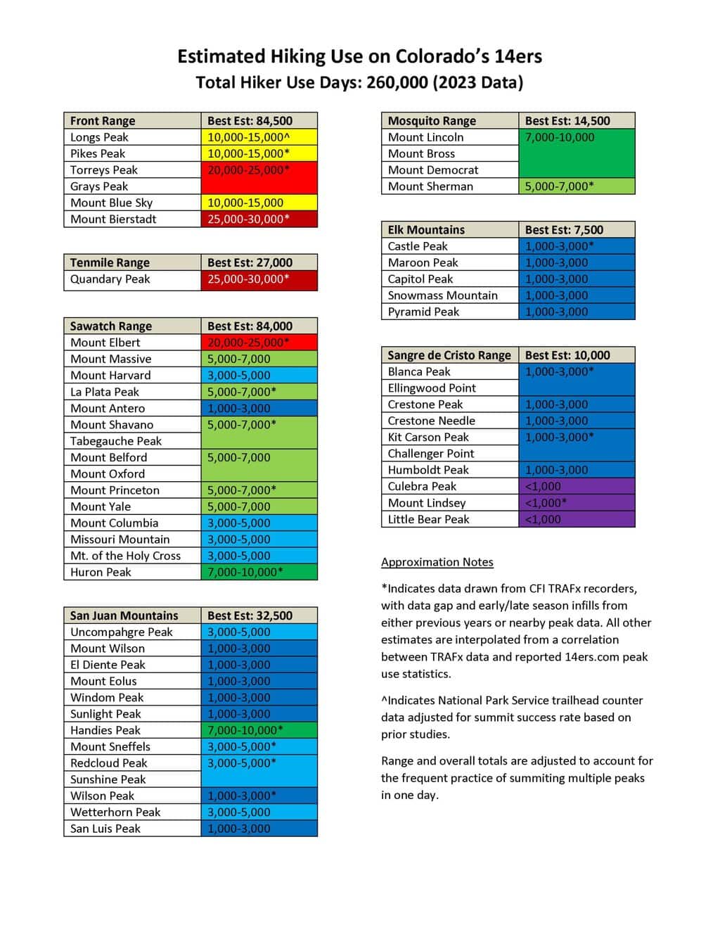
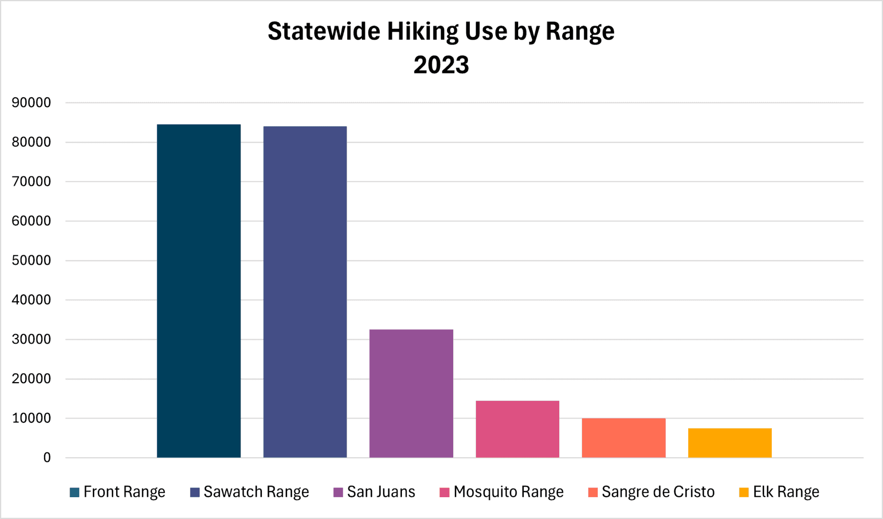
One of the primary factors contributing to this decline was the closure of the popular Decalibron Loop near Alma for much of the season due to private landowner liability concerns, resulting in a 17,500-day drop (-55%) in the Mosquito Range. Hiking use also decreased in three of Colorado’s seven ranges containing 14ers, including the popular Front Range closest to the Denver metro area. Meanwhile, peaks such as Mount Bierstadt and Quandary Peak remained the most popular, each with use estimated in the 25,000-30,000 hiker days range.
CFI’s estimate of hiking use suggests a statewide economic impact of $70.5 million directly attributable to hiking 14ers in 2023, based on past economic expenditure studies performed by Colorado State University economists John Loomis and Catherine Keske. Their 2009 study found that climbers of Quandary Peak near Breckenridge spent an average of $271.17 per day on gasoline, food, lodging, equipment, and other retail purchases. Given the decade-old data, these figures are likely understated in today’s economic context.
[i] Loomis, John and Catherine Keske, “Did the Great Recession Reduce Visitor Spending and Willingness to Pay for Nature-Based Recreation? Evidence from 2006 and 2009,” Contemporary Economic Policy, Vol. 30, No. 2, April 2012, pp. 238-246.
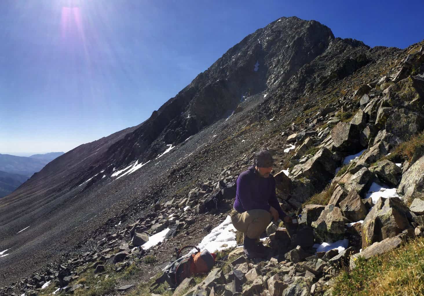
Lloyd Athearn installing an infrared trail counter just below the summit of Mount Lindsey.
CFI uses “hiker use days” to represent one person hiking one peak on a given day, offering a comprehensive view of hiking activity on Colorado’s 14ers. By understanding hiking use levels, seasonal dispersal, and trends over time, CFI can better assess the impact of hiking on the fragile alpine environments of Colorado’s 14ers, guiding efforts to preserve these unique landscapes.
In 2020, Matt Albritton, a Yale undergrad studying computer science and engineering, helped further refine CFI’s data modeling program that was originally developed in 2016. Matt cleaned and rewrote the program’s code and created an updated version using Python. The program helps fill in gaps in the data due to obscured counter sensors or periods in the early or late season when the counter is not in place. This model incorporates the week of the season, day of the week, holidays, and similar peaks with data to fill in missing data. See an example below of the predicted vs. measured data.
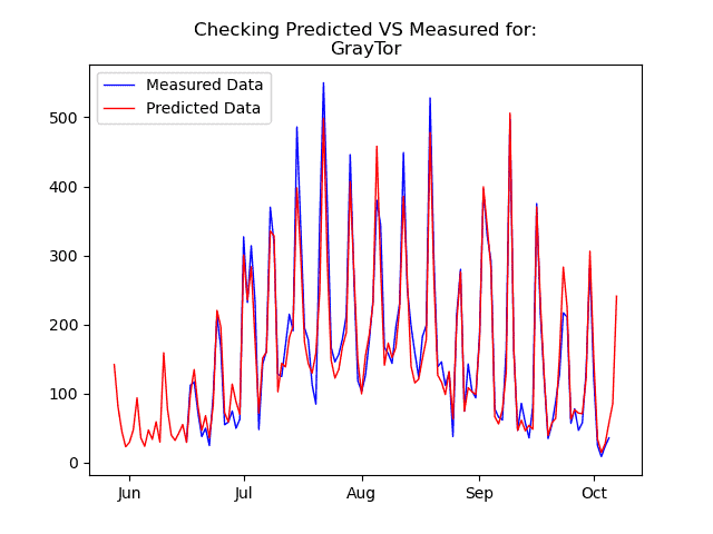
CFI uses a multi-factor modeling program to predict hiking use levels when we do not have a counter on a given peak or when there are data gaps. The program’s modeled data for use levels on Grays and Torreys (red line) largely mirror what was actually recorded by our counter (blue line). The program’s predictions are helpful to fill in the early season gap when CFI’s trail counter was not yet in the field.
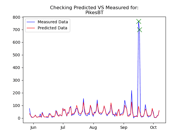
In this chart, we again see that CFI’s program has accurately predicted hiking use on Pikes Peak’s Barr Trail (red line). However, the program did not anticipate the increased hiking use which occurred in September during the Pikes Peak Ascent and Marathon. CFI flags these outliers (green X) in our modeling program to ensure that estimates for other peaks do not include these spikes in use.
Special thanks goes out to CFI’s summer CLIMB interns Emily Barnes (2016), Claire Gomba (2017), Nick Dahl (2018), Jackson Burton (2019), Matt Albritton (2020), and Farah Stack (2021) who helped place trail counters, analyze data, and refine CFI’s estimates.
Additional Links:
2022 14er Hiking Use Estimates
2021 14er Hiking Use Estimates
2020 14er Hiking Use Estimates
2019 14er Hiking Use Estimates

